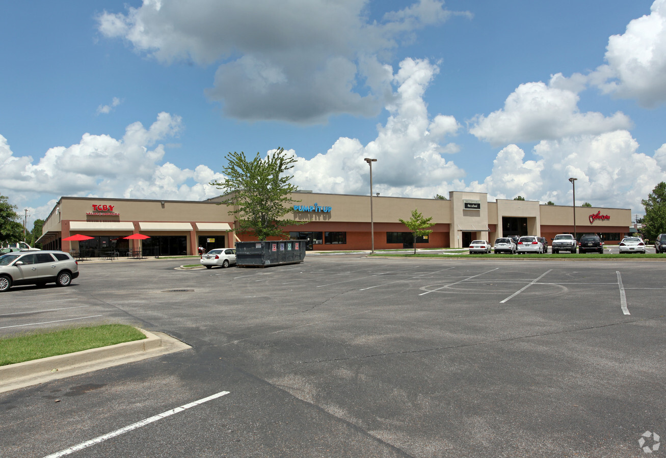
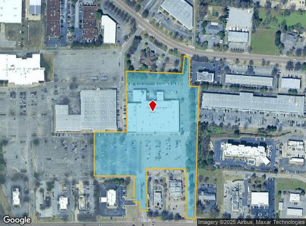
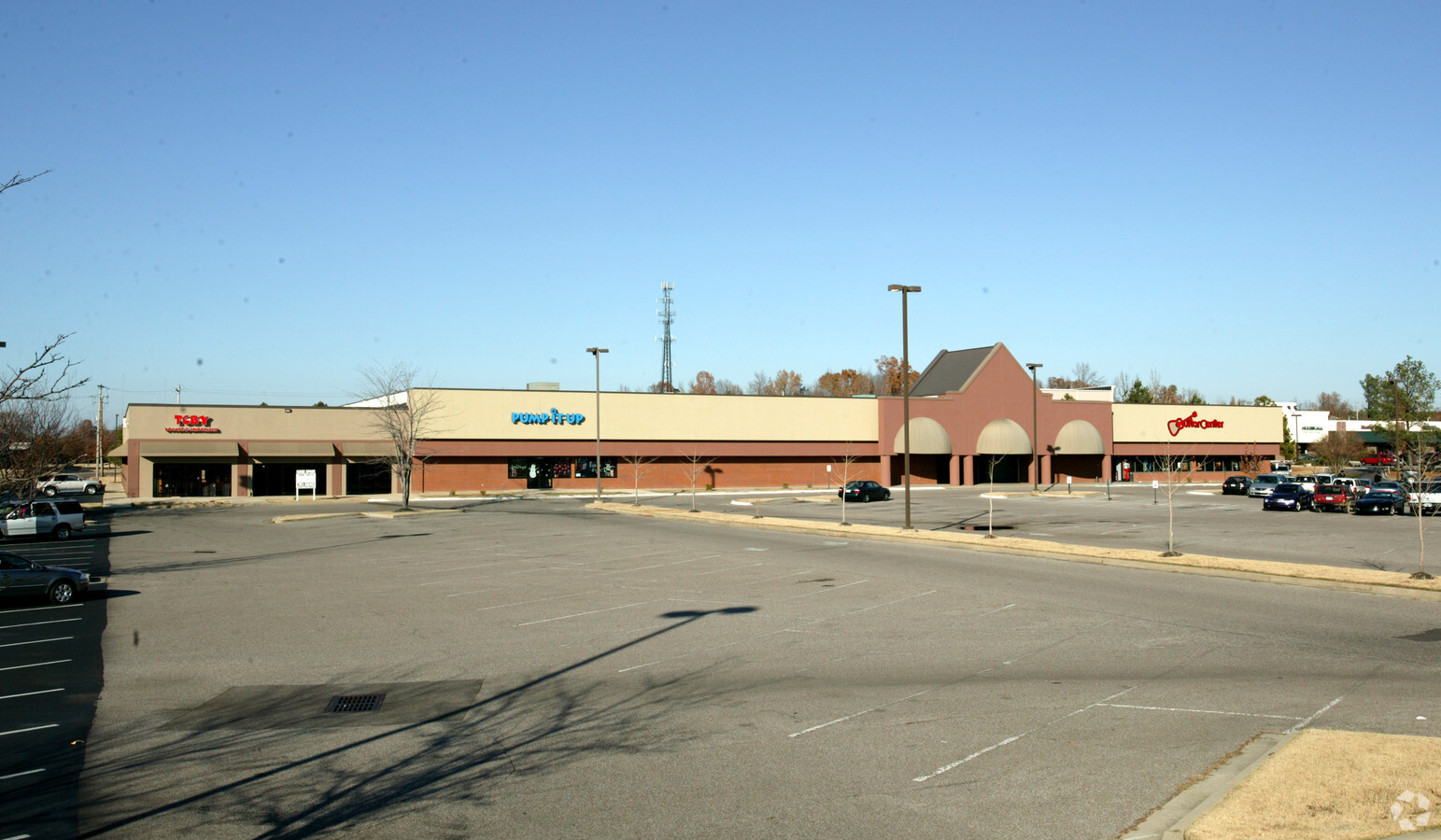
Property Record
8000 Us Highway 64, Bartlett, TN 38133
NEARBY LISTINGS FOR SALE OR LEASE
Property Detail
8000 Us Highway 64
Memphis, TN-MS-AR
Bartlett Corp Park Eastph 2
B0-158I-B0-0045
SS STAGE HILLS BLVD TO NS US HWY 64 SEE MAP 105D BARTLETT CORPORATE PARK EAST PH 2
Regionalshoppingcenterormallwithanchorstore
Shelby
X
Tennessee
47157C0310G
42a
2023
8.17 AC
2024
Northeast
020632
Memphis
72,009 SF
DEMOGRAPHICS near 8000 Us Highway 64
1 Mile
3 Mile
5 Mile
2024 Total Population
3,210
57,977
150,889
2029 Population
3,111
56,270
146,528
Pop Growth 2024-2029
(3.08%)
(2.94%)
(2.89%)
Average Age
37
39
38
2024 Total Households
1,286
22,211
58,561
HH Growth 2024-2029
(3.11%)
(3.03%)
(2.96%)
Median Household Inc
$73,139
$70,345
$71,912
Avg Household Size
2.40
2.50
2.50
2024 Avg HH Vehicles
2.00
2.00
2.00
Median Home Value
$196,331
$228,667
$228,856
Median Year Built
1991
1991
1991
Nearby Places
- Restaurants
- Banks
- Shops
- Fitness
- Groceries
Nearby Properties
Address
Land Use
TOTAL SIZE
Lot Size
Zoning
Address
Land Use
TOTAL SIZE
Lot Size
Zoning
270,045 SF
28.34 AC
CA
Address
Land Use
TOTAL SIZE
Lot Size
Zoning
231,038 SF
24.97 AC
RU-2
Address
Land Use
TOTAL SIZE
Lot Size
Zoning
591,149 SF
45.48 AC
CMU-3
Address
Land Use
TOTAL SIZE
Lot Size
Zoning
1,153,892 SF
50.47 AC
I-P
Address
Land Use
TOTAL SIZE
Lot Size
Zoning
325,370 SF
64.04 AC
CA
Address
Land Use
TOTAL SIZE
Lot Size
Zoning
207,537 SF
21.73 AC
C-G
Address
Land Use
TOTAL SIZE
Lot Size
Zoning
134,272 SF
28.85 AC
CMP-1
Address
Land Use
TOTAL SIZE
Lot Size
Zoning
75,099 SF
12.22 AC
EMP
Address
Land Use
TOTAL SIZE
Lot Size
Zoning
338,215 SF
33.08 AC
CA
Address
Land Use
TOTAL SIZE
Lot Size
Zoning
101,701 SF
39.63 AC
M-R
Address
Land Use
TOTAL SIZE
Lot Size
Zoning
19,050 SF
24.99 AC
R-M
Address
Land Use
TOTAL SIZE
Lot Size
Zoning
64,002 SF
67.10 AC
RU-2
Address
Land Use
TOTAL SIZE
Lot Size
Zoning
79,341 SF
31.15 AC
RU-3
Address
Land Use
TOTAL SIZE
Lot Size
Zoning
86,056 SF
24.14 AC
CA
Address
Land Use
TOTAL SIZE
Lot Size
Zoning
498,680 SF
46.61 AC
I-P
Address
Land Use
TOTAL SIZE
Lot Size
Zoning
253,831 SF
16.74 AC
EMP
Address
Land Use
TOTAL SIZE
Lot Size
Zoning
62,852 SF
10.15 AC
RS-12
Address
Land Use
TOTAL SIZE
Lot Size
Zoning
108,678 SF
8.99 AC
R-E
Address
Land Use
TOTAL SIZE
Lot Size
Zoning
39,581 SF
7.69 AC
R-6
Address
Land Use
TOTAL SIZE
Lot Size
Zoning
133,020 SF
11.73 AC
SC-1
Address
Land Use
TOTAL SIZE
Lot Size
Zoning
105,950 SF
21.19 AC
RU-3
Address
Land Use
TOTAL SIZE
Lot Size
Zoning
222,468 SF
37.55 AC
C-H
Address
Land Use
TOTAL SIZE
Lot Size
Zoning
142,703 SF
18.62 AC
CMU-3
Address
Land Use
TOTAL SIZE
Lot Size
Zoning
56,431 SF
1.24 AC
C-G
Address
Land Use
TOTAL SIZE
Lot Size
Zoning
199,320 SF
9.05 AC
CA
Address
Land Use
TOTAL SIZE
Lot Size
Zoning
191,316 SF
21.71 AC
CMU-3
Address
Land Use
TOTAL SIZE
Lot Size
Zoning
86,875 SF
7.09 AC
I-P
Address
Land Use
TOTAL SIZE
Lot Size
Zoning
167,748 SF
17.40 AC
CA
Address
Land Use
TOTAL SIZE
Lot Size
Zoning
256,617 SF
10.54 AC
I-P
Address
Land Use
TOTAL SIZE
Lot Size
Zoning
134,599 SF
6.43 AC
I-P
The World's #1 Commercial Real Estate Marketplace
Connect with us
© 2025 CoStar Group
The information above has been obtained from sources believed reliable. While we do not doubt its accuracy we have not verified it and make no guarantee, warranty or representation about it. It is your responsibility to independently confirm its accuracy and completeness. Any projections, opinions, assumptions, or estimates used are for example only and do not represent the current or future performance of the property. The value of this transaction to you depends on tax and other factors which should be evaluated by your tax, financial, and legal advisors. You and your advisors should conduct a careful, independent investigation of the property to determine to your satisfaction the suitability of the property for your needs.